 Back to Saint Francis Dam Driving Tour by History Cake
Stop 13 of 20
Geology of the Santa Clara valley its watershed
The Santa Clara River watershed is located within a very geologically active area and is prone to earthquake driven landslides
Fillmore, CAWritten by historians, never AIResearched & written by Marc Striegel
In the app, this story plays on its own as you reach this spot. This page is the preview.
See the full tourListen
Narration
In the app, the full narration plays when you're on location.
The story
Geology of the Santa Clara valley its watershed
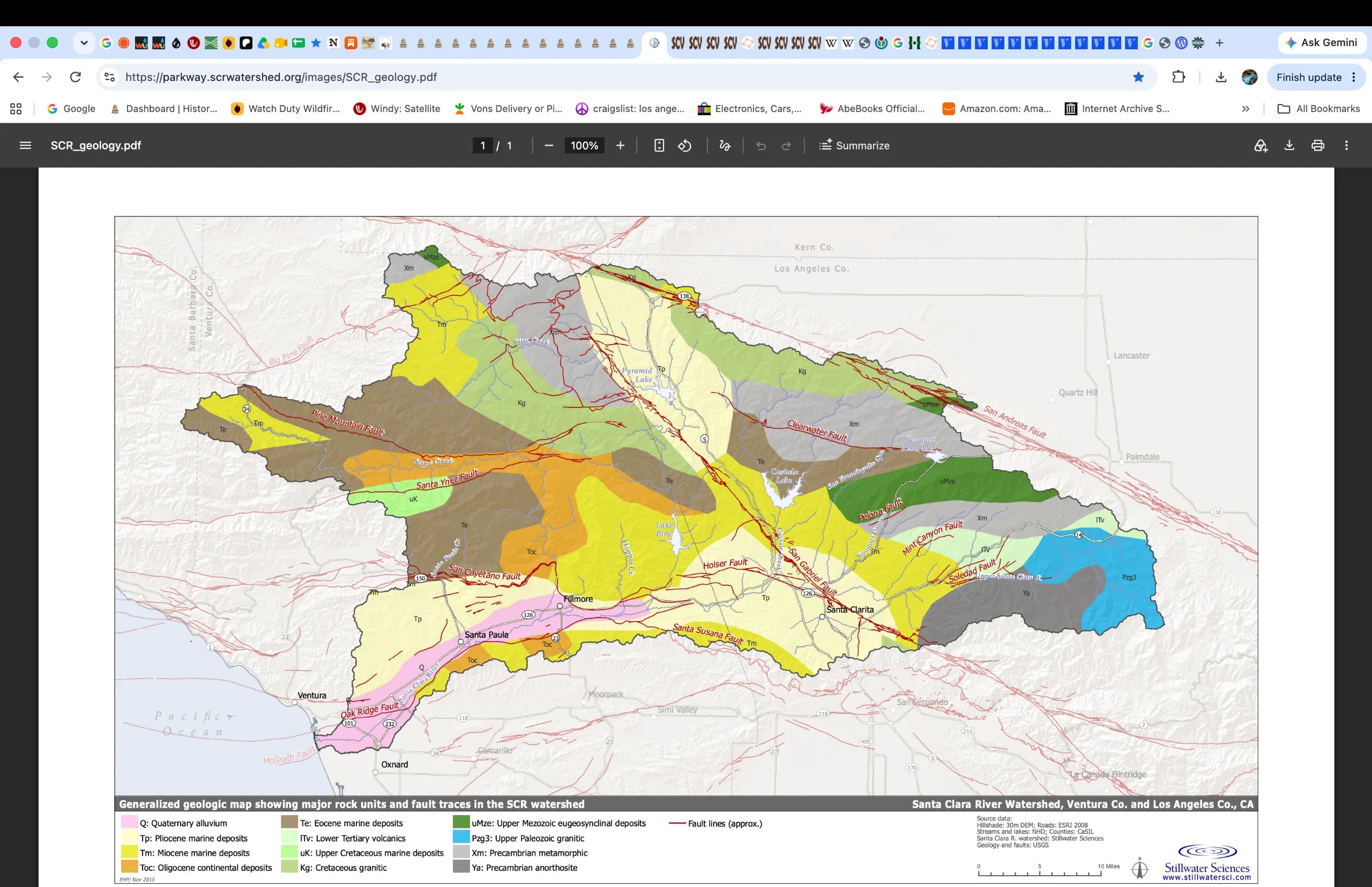
The Santa Clara River watershed is located within a geologically active area, within the San Andreas Fault system, which forms the dynamic boundary between the Pacific and North America tectonic plates. Relative motion of the plates includes strike-slip displacement (along the trend of the fault zone) and convergence (acting perpendicular to the fault zone).
Convergence along the boundary has led to rapid uplift in coastal and interior mountain ranges throughout the region and you see them north and south of you as you roll along the road.
Persistent regional geologic instability since about 28 million years ago has exposed a wide variety of highly deformed, fractured, and faulted rock types in the Santa Clara River watershed
Igneous and metamorphic rocks, including gneiss, schist, and granite, dominate in the upper watershed to the east above Fillmore, while younger sedimentary and volcanic rocks are more prevalent in the lower watershed, west of the San Gabriel Fault.
Fractures, deformation, and faulting contribute to high bedrock erodiblity throughout the watershed. The position of unchanneled valleys, creeks, and the Santa Clara River itself are strongly influenced by geologic structure and the location of active faults.
Intense seismic activity in the region is reflected in frequent ruptures along faults. Seven of the roughly 30 magnitude six and above earthquakes that have shaken southern California over the past 80 years have occurred in the Transverse Ranges.
Seismic shaking during the magnitude 6.7 Northridge event in 1994 triggered nearly 7,400 landslides in the watershed (Harp and Jibson 1996), highlighting the importance of geologic factors in the production of sediment, which ultimately affects geomorphic processes in the lower river corridor
On the route
Where it sits
In the app, this stop triggers as you arrive.
You are here

Out now
Hear it where it happened.
Get the free app, stand where this happened, and the story starts on its own.