Back to Tours
Driving tour
Saint Francis Dam Driving Tour - Overview
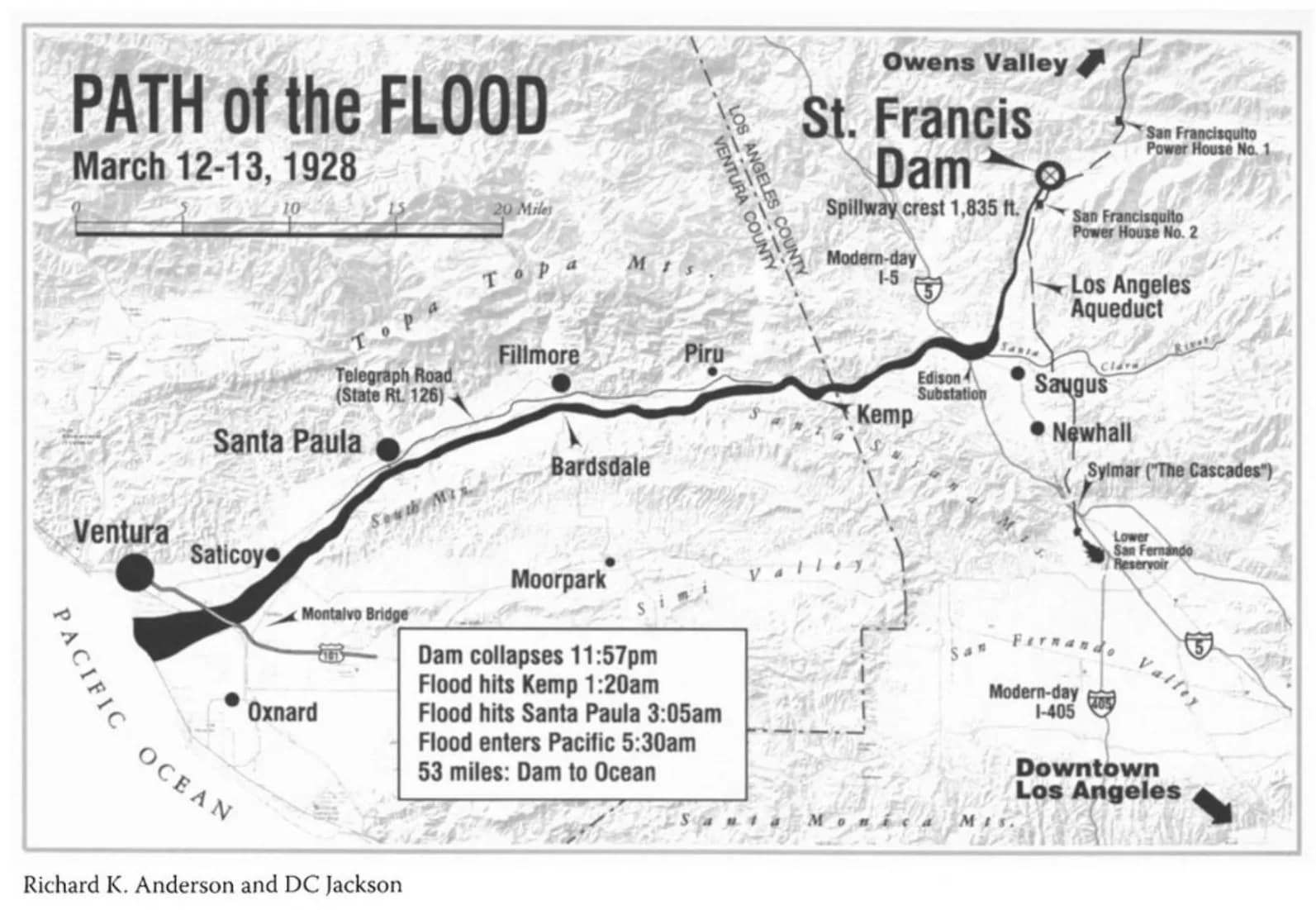
Welcome to HistoryCake, the Saint Francis Dam Disaster tour. To follow the path of the flood, we begin at the old site of the dam face, about seven and a half miles up San Francisquito Canyon Road north of Saugus.
14 storiesWander freelyFree
Travel mode
Built for hands-free listening while the road reveals what happened along the way.
Story timing
Stories can be found in any direction. Wander through the area and let nearby locations cue themselves as you arrive.
Access model
Start this tour free and hear how History Cake layers place, timing, and story.
Tour access
Start listening without a purchase.
Open the tour in the app and let each story arrive when the place is ready for it.
Included in this tour
- 14 story stops with imagery and context.
- Listening designed for hands-free travel days.
- A clear first taste of the product before you buy deeper tours.
Free tour
Stories
14 story locations
Browse the layers on the web, then let the app handle the timing when you travel.
Shape
Open exploration
Use this to tell whether the tour fits a quick stop, a slow walk, a long drive, or time in the air.
Time
Flexible
A quick sense of the listening time before you make room for it in the trip.
About this tour
The layers behind this route.
Get the background, themes, and historical texture before you take the tour with you.
From: Saint Francis Dam Disaster Site - 32300 San Francisquito Canyon Rd, Santa Clarita, CA 91390, USA
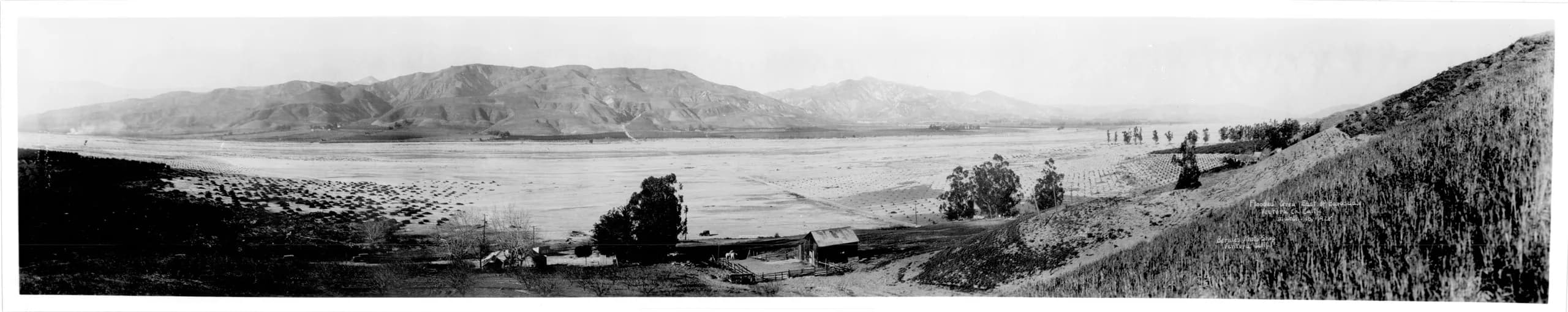
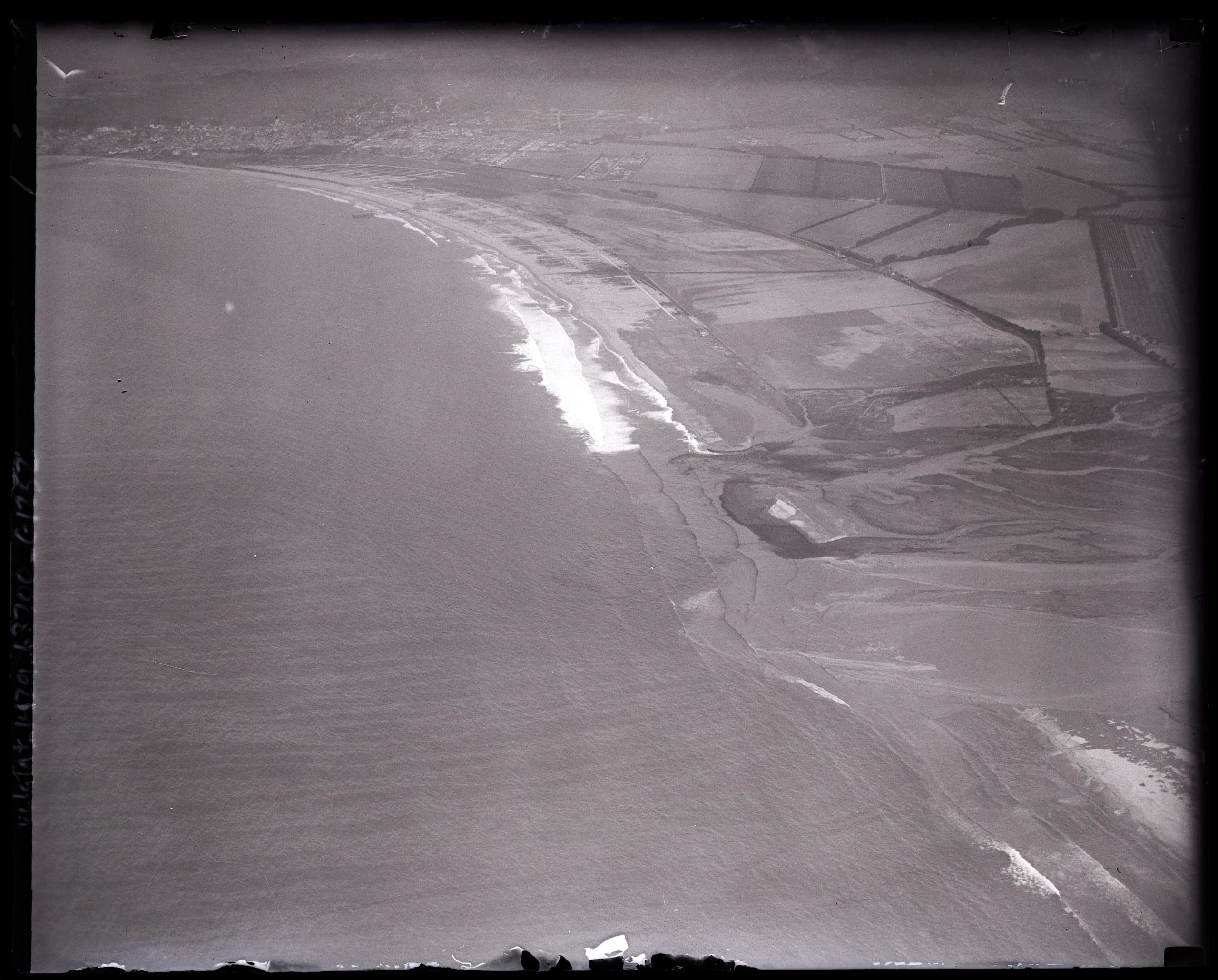
To: Oxnard Harbor where the Santa Clara river meets the Pacific Ocean
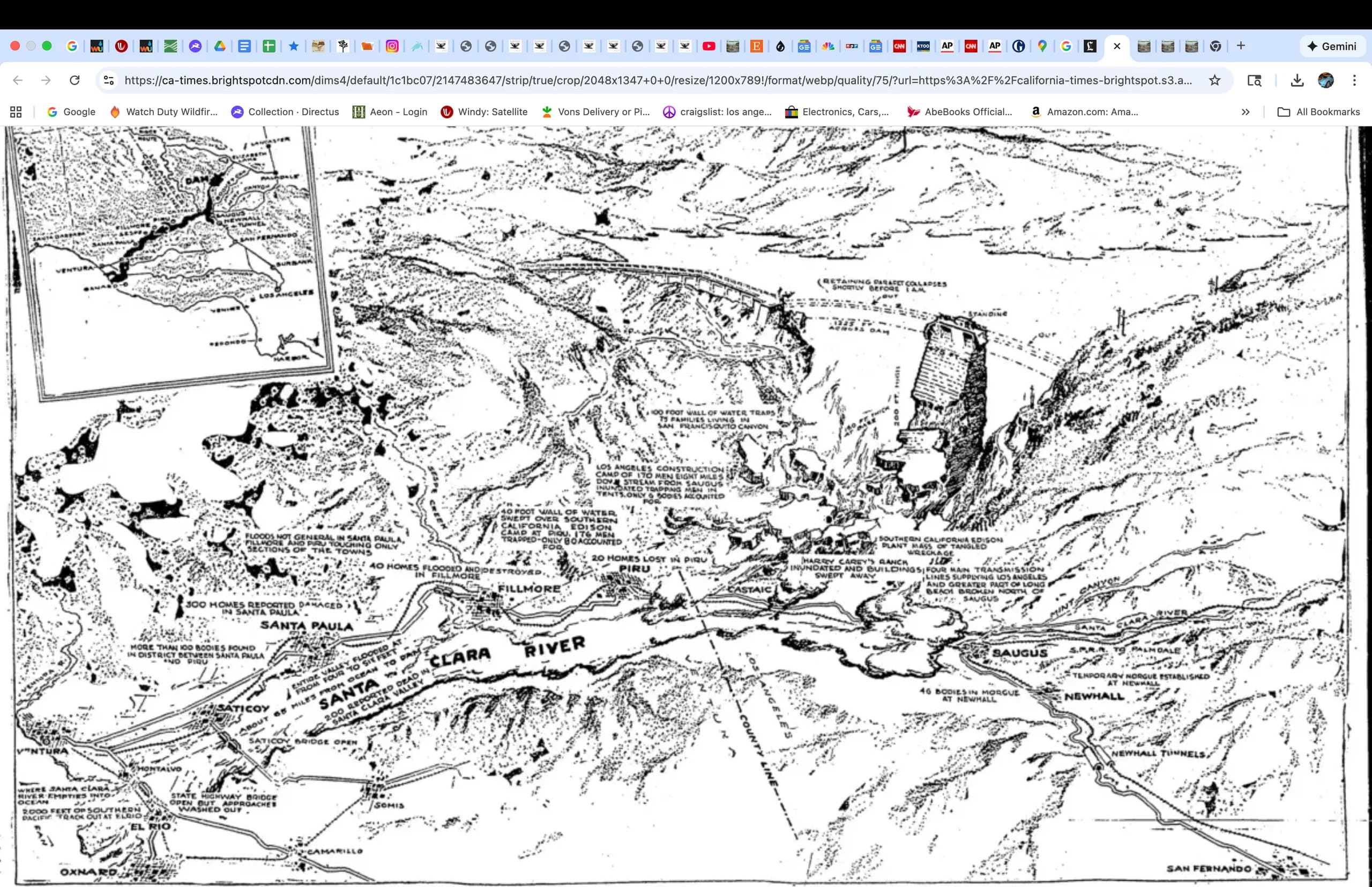
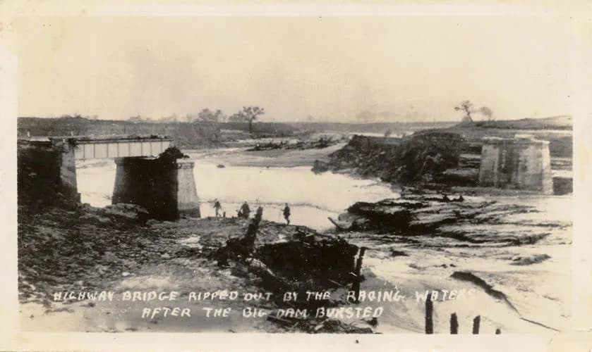
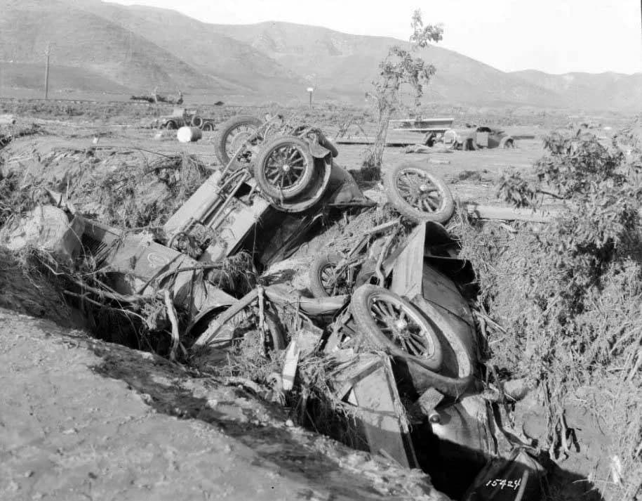
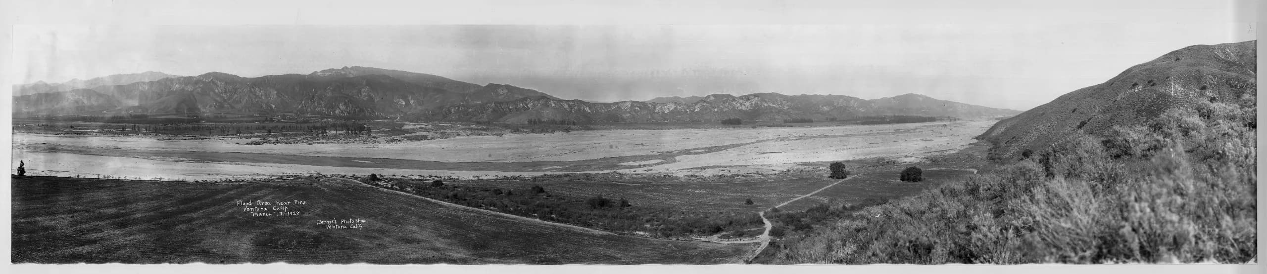
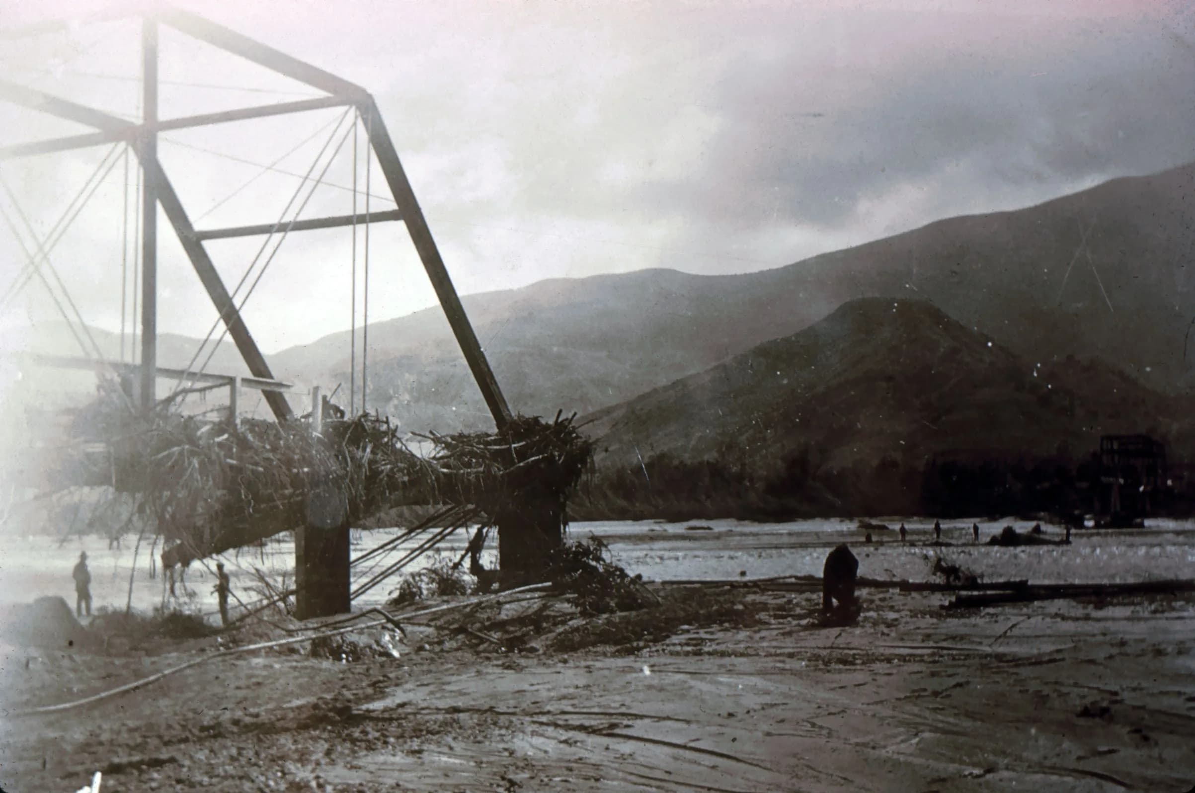
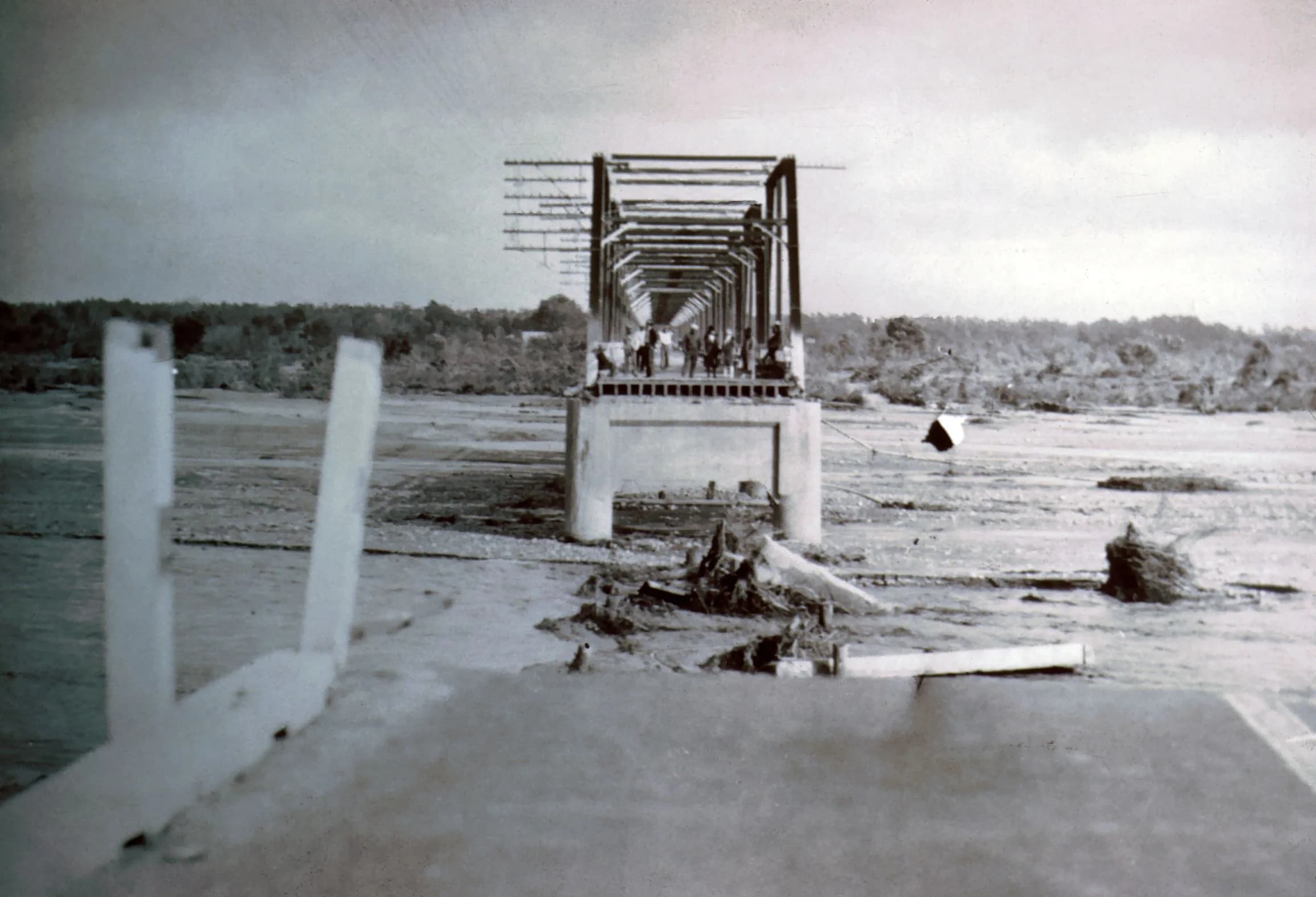
It is a cold March night in 1928 in the Santa Clara River Valley and deep up the San Francisquito Canyon. Just a few minutes shy of midnight, a tremendous flood was unleashed and before it reached the ocean a few hours later, it would take between 400 and 500 lives with it.
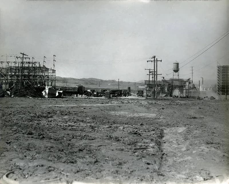
Families and workers deep in their sleep or frantic in escape efforts were fighting an awesome unseen enemy in the frigid morning air. Along with homes and lives, it coldly wipes out the communications and power systems of the day, lines on poles strung along the roads - now rendered impassable.
The northernmost tentacle of the octopus of the county of Los Angeles in the 1920s had its lifelines clipped by a hazard of its own making. The largest man made disaster in the history of California and second only to the San Francisco earthquake and subsequent fire overall was occurring...
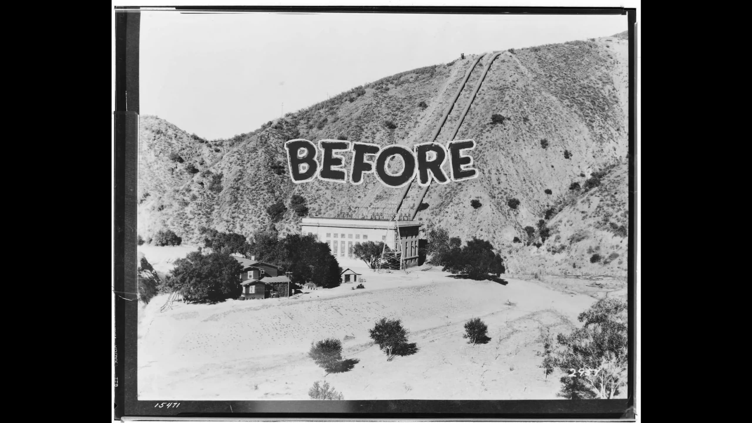
A dam had failed upstream - this St Francis Dam in San Francisquito Canyon was a key piece of the city's drought resistance strategy led by the department of water and power and its chief, William Mulholland. By diverting waters from the Owens Valley and channeling them down to Los Angeles via the aqueduct he oversaw the construction of, they also built reservoirs along the way to store water and generate electricity through controlled release.
As you stand and view the opening photographs and imagine the 14 story wall of concrete in front of, and looming over you, the thought of relocating to higher ground might just creep in as you consider the 14 billion gallons of water just behind it.
Through the eyes of survivors and the deeds of heroes and the terror of those who were not as fortunate, you will hear a story of manmade disaster and the failure of the best efforts of brilliant men trying to contain nature and save now for a string of not so rainy days certain to come again in the future...
It is a tragic and sad and mournful story and it is hard to drive to the beach on the 126 highway without your mind's eye painting a picture of a night 100 years ago we all wish had never happened.
Tour overview
See where each story lives
These are story locations, not a required sequence. Visit them in whatever order fits your day.
driving tour
14 stops
Wander freely in any order
Story lineup