 Back to HistoryCake Driving Tour - Highway 14 and the 395 - Welcome and Overview
Point of interest · Other
395 and 14 SFV to Reno - Overview 2
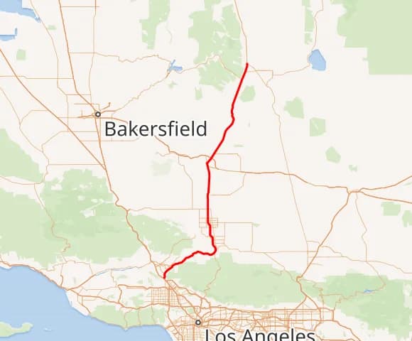
The road beneath you, State Route 14, is the spine of this journey's first half. From the edge of Los Angeles it climbs through Soledad Canyon and across the high desert of the Antelope Valley, past Edwards and aerospace country, before handing you off to US-395 near Inyokern.
Rosamond, CAWritten by historians, never AIResearched & written by Marc Striegel
In the app, this story plays on its own as you reach this spot. This page is the preview.
See the full tourThe story
395 and 14 SFV to Reno - Overview 2
The highway carrying you north is California State Route 14. It begins back at Interstate 5 in Sylmar, on the northern lip of the San Fernando Valley, and runs up to meet US-395 near Inyokern — the seam where this tour's desert miles give way to the long Owens Valley run.
Its lower stretch, the Antelope Valley Freeway, is one of the busiest commuter routes in the state, funneling Santa Clarita, Palmdale, and Lancaster toward Los Angeles. But north of Palmdale the traffic thins and the character changes. Here the road carries a fitting second name: the Aerospace Highway. It threads the boundary between the Mojave's heat and the rising wall of the Sierra Nevada, passing the dry lakes of Edwards Air Force Base — once a primary runway for the Space Shuttle — and pointing toward the Navy's vast China Lake ranges. For decades the skies above this asphalt have been a proving ground for rockets, jets, and record-breaking flight.
So as you drive, remember you're tracing a corridor that has always been about movement: Native trade paths, wagon and stage roads, the railroad, and now a ribbon of pavement between the city and the wide-open desert.
On the route
Where it sits
In the app, this stop triggers as you arrive.
You are here


Almost here
Hear it where it happened.
The History Cake app is in the final stretch. Leave your email and we'll send one note when this story can play for you on the spot.
Be first in line
One email at launch. No worries, no spam.