An audio tour that plays itself. Each story starts as you drive past the place it happened.
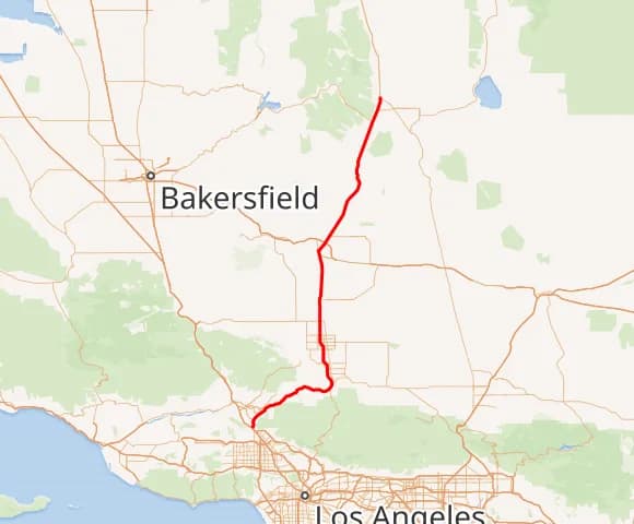
Highway 395 runs north–south up the eastern side of California, above the Cajon Pass; Highway 14 climbs from the San Fernando Pass through Mojave to meet it near Inyokern, just west of Ridgecrest. Today we journey through the past of the land around you — and the hooves and footprints of those who came before. Welcome to HistoryCake!

On the ground
Get the app, pick this tour, and download it. Everything works offline after that.
The route
Numbered stops show the listening order. Off-path points of interest are marked separately.
Almost here
The History Cake app is in the final stretch. Leave your email and we'll tell you the day this tour is ready to play.
One email at launch. No worries, no spam.
Follow the route with your phone in your pocket. Nothing to tap.
Each one begins the moment you reach the place it's about.
Researched & written by
Marc Striegel
About this tour
No matter where you join the road — heading up the highway or across the state on these eastern routes — you cannot escape the past. The desert and the mountains feel timeless, even as they are forever changing, and for most of us they stir wonder and a fire of curiosity. So sit back, enjoy the journey as much as the destination, and let's travel back to the days of bandits and lawmen, ranchers and argonauts, Native Americans and giant ground sloths, ice ages and the deep time before. You take care of the road; we'll take care of the rest. You can pause the tour at any time from the settings menu.
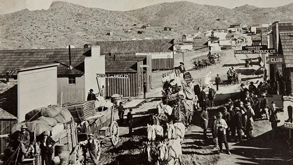
Long before the gold-seekers and the merchants who supplied them arrived in 1849, this land was home to Native peoples — from the Mojave in the south to the Paiute and Shoshone of the Owens Valley. Their intertwined histories hold the deep past of the eastern Sierra Nevada and the long ebb and flow of people and goods along a well-trodden path toward its sprawling, hungry neighbor to the south: Los Angeles.
California is a vast and varied state, but nowhere does terrain speak louder than on the eastern flank of the Sierra Nevada. Near Lone Pine, US-395 threads between the highest point in the lower 48 — Mount Whitney — and the lowest point in North America, Badwater in Death Valley: nearly three vertical miles apart, yet only about 85 miles as the crow flies.
As highways so often do, these follow footpaths first walked some ten thousand years ago. The Paiute and Shoshone navigated the great valley and the ranges on either side, crossing the harsh desert to the south as the seasons and trade with other tribes invited.
The Spanish and Californio families built a pastoral life of cattle and farming on the western side of what would become California; they never settled the Owens Valley. It was the flood of men from across the globe after gold was discovered in 1848 that brought the first real crowds through the valley, bound for El Dorado on the Sierra's western slope. Most simply passed through.
Over the miles ahead we'll trace it all: the geology underfoot, the flora and fauna then and now, the mines and the minerals pulled from the earth across the decades, the outlaws and the lawmen, the settlers and their towns, and the farms and ranches that fed them.
Optional stops nearby — they play too, but aren't on the route.
Off to your east, on what's now Edwards Air Force Base, a hard-living aviatrix named Pancho Barnes ran a desert dude ranch where test pilots like Chuck Yeager drank, danced, and earned a free steak for breaking the sound barrier. It burned in 1953 — but lives on in The Right Stuff.